Tag Archives: TD

Ernesto Getting Better Organized, TD #6 Develops, Invest 91L Along the Florida Coastline

Tropical Weather Outlook for August 4th, 2012

Hi again and thanks for stopping by to read another tropical weather outlook. August is wasting no time becoming very active, with three areas worth watching, two of those now designated as tropical cyclones. Ernesto is still the main story, as it continues to turn across the Caribbean and appears to be getting better organized. TD #6 is new to the world, but is way out in the East Atlantic, just off the African Coastline. Finally, we have an invest much closer to the United States. I’ll talk about each feature in Today’s outlook!


Tropical Storm Ernesto

Visible/Infrared Imagery Animation of Tropical Storm Ernesto

After a difficult day fighting westerly vertical wind shear and dry air intrusions, Ernesto has re-organized somewhat overnight. Ernesto looked like skeleton last night with limited deep convection and only minor rain bands surround the circulation on radar. However this past evening, deep convection is much more organized surrounding the center in all quadrants alongside improved banding features which are indicating a better organized system. A deep burst of convection earlier has resulted in an expansion of outflow to the western side of the circulation, the first time this has happened by any significant margin. Water vapor shows this nicely, with upper level easterlies pushing the outflow ahead of the system. Vertical wind shear as a result has decreased to 5-10 knots as an upper level anticyclone builds over the system. This low vertical wind shear, alongside both warm sea surface temperatures (SSTs) and very high oceanic heat content (OHC) spells a recipe for further intensification. One slight limiting factor might be lower precipitable water in the storm’s path. However, in a low shear regime this lower atmospheric water vapor won’t be as much of a limiting factor. In fact, its primary impact might be to limit the size of Ernesto as it moves westward across the Caribbean. So now that I’ve gotten the past and present out of the way, where is Ernesto going, and will this pose a threat to land as a significant Tropical Cyclone down the road?

ECMWF in 3 hour intervals. Plotted are 925 hPa heights (black contours), 500 hPa vorticity (shaded), and 500 hPa heights (white contours).

To illustrate this threat, lets first talk about track of Ernesto. Normally I would show a 500 hPa plot of both the ECMWF and contrast it with the GFS. However, both global models are having a hard time accurately depicting the circulation, especially after the recent organization that has taken place overnight. Instead I want to illustrate why I think the ECMWF (and to a lesser extent the GFS) might not have the correct solution. Pictured above is the 925 hPa heights from the ECMWF from 00z Last Night to 12z on August 5th. Overlaid is the 500 hPa vorticity and heights. Notice how the low-level circulation quickly runs out away from the mid-level circulation. This typically occurs when there is significant vertical wind shear. I am having a hard time believing that the low-level flow is going to rapidly increase to the point that it causes the low-level and mid-level centers of Ernesto to decouple. This problem with this forecast is that the vertical wind shear over Ernesto is decreasing currently. As long as the low and mid-level centers do not separate, we should see a more vertically coherent system which should be able to feel the weakness in the Mid-latitude trough that will develop over the Gulf of Mexico in the longer range.

ECMWF 120 Hour Forecast at 500 hPa. Note the weakness in the Gulf of Mexico.

The track guidance splits in the long range mainly due to differences in intensity. I ultimately believe the most rightward tracks will prevail, especially if Ernesto intensifies more than expected. Intensity wise, things will probably still be slow going for the next 24-48 hours as the storm develops an inner core and negates some of the dry mid-level air nearby. However, once the storm is in the Western Caribbean all things are a go for robust development, and rapid intensification won’t be out of the question. The intensity guidance is very bullish, especially the statistical models. At this point, I’ll stay on the low side for the firt 24-48 hours, but beyond Ernesto could rapidly intensify and that will be reflected in the forecast.

Forecast #1 for Tropical Storm Ernesto

Here is my first forecast for Ernesto. You can see that in the short term I have Ernesto only slowly intensifying until it reaches the Western Caribbean. From here rapid intensification takes place between 72-96 hours, although the time period where this takes place will be exceptionally difficult to forecast. From there it is likely that Ernesto will clip the Yucatan Peninsula which will limit its maximum intensity. Still though, I think this is a very bullish forecast in the long term. Stay tuned for updates in the days to come!


Tropical Depression #6

Visible/Infrared Animation of Tropical Depression #6

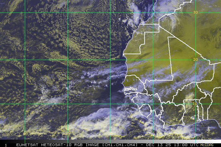
Tropical Depression #6 formed last night way out in the East Atlantic close to the Cape Verde islands. While the system was originally being sheared from the northeast, a recent microwave pass shows substancial organization since then, with even hints of an eyewall trying to develop. Needless to stay this system is likely intensifying as we speak and we will likely be looking at Tropical Storm Florence later today. The future for this system outside of the short term though, looks rather bleak, with cooling SSTs and a dry stable Saharan Air Layer that might put a damper on convection beyond 48 hours. Consequently, both the GFS and ECMWF dissipate the system beyond 72 hours. I’ll keep you updated on this system as well in the days to come.


Invest 91L

Enhanced Infrared Image of Invest 91L

Finally on our list we have Invest 91L. This system developed yesterday afternoon from an old tropical wave that is now interacting with an upper level low. More recently, the upper level low has been moving away which has lead to slightly more favorable conditions. However, the system will have to get more organized soon before it moves inland over Florida. Thus far, radar animations show that the convection with the system is still meager, and it will take a substancial uptick in convection for this system to organize further. At this time I’m giving 91L a 30% chance of development, which is slightly higher than the National Hurricane Center (NHC) currently.


And that’s all I have (phew) for todays tropical weather outlook. Look for another update tomorrow!

Invest 96L Getting Better Organized, Track Remains Uncertain

Tropical Activity for June 23rd, 2012

The tropics continue to remain unusually active over the past few days, first with Chris turning up the maritime waters in the far North Atlantic, and now Invest 96L which looks to do some water turning of its own as it spins across the Gulf of Mexico. Now that Chris has become a post-tropical disturbance, our attention shifts to 96L which is poised to be the big tropical topic of discussion into the next work week. I’ve got the latest details below.


Invest 96L

Infrared Imagery of Invest 96L

Invest 96L has been taking its sweet time getting organized, the biproduct of a large gyre-like disturbance that organized through a northward progression of the intertropical convergence zone (ITCZ) merging with a disturbance off the Panama coast. Now the feature has been slowly moving northward in the Gulf of Mexico. Don’t let the convection fool you, the center is actually further west in region mainly devoid of convection currently. However, there are individual meosvorticies that are rotating around a larger mean center that are interacting with the convection. The lopsidedness nature of the system is partially due to 20-30 knots of westerly vertical wind shear over the circulation, which is being caused by a upper level trough dropping down from Texas into the Western Gulf of Mexico. This has caused the upper-level anticyclone to be displaced further east of the storm. All of these factors will probably prevent rapid development in the short term, although the system is still gradually getting better organized, and we will likely see tropical cyclogenesis (TCG) sometime in the next 24-48 hours. I am in agreement with the NHC’s assessment that this system has an 80% chance of development in the next 48 hours. With that said, what does the future hold; how strong can 96L get, and where is it going to go?

500 hPa model evolution of both the ECMWF and GFS runs from 00z on 23 June. Plotted are the 500 hPa absolute vorticity (shaded) as well as the geopotential heights (contours). Relevant features are highlighted

Trackwise, things are very much split at this time. This is highlighted in the most recent plot of the model track guidance, showing two main groups taking the system is opposite directions. This difference is highlighted by looking at both the 00z runs of the ECMWF and GFS. The first observation worth noting is that there are not huge differences in the mid-level pattern between each run in the 24-48 hour time frame. The ECMWF does have a touch more ridging in place at 48 hours, but this difference is minor. What is significant though is the estimate position of 96L in both time frames. The ECMWF is distinctly further south and ever so slightly further west. This allows the system to be captured by the easterly flow on the back of an amplifying ridge, which then steers the system westward towards the Texas coastline. The GFS is the polar opposite. The system goes too far north, so the ridge is not able to capture the disturbance fully. Instead, the mid-latitude flow associated with an amplifying trough in the Eastern United States captures the system and the westerly flow associated with the East US trough draws the storm eastward across Florida and then out into the open Atlantic. While these differences are extreme, 96L starts off in very similar positions for the first 24-48 hours, which highlights how key the initial location of this system is. With gyre like circulations such as this, individual mesovortices often can pull a mean center towards that piece of vorticity if the feature is strong enough. Since the convection will likely be focused on the eastern flank of the circulation, there is a decent chance one of those mesovortices could pull the system further east than expected in the short term. This would tend to lend credence to the GFS solution. If the system moves too far northward, it could very well be captured by the amplifying trough that will dig into the east by 72 hours. At this point, its difficult to make a call either way due to the formative nature of this disturbance, but it is likely we will have better agreement by this time tomorrow when the circulation becomes better defined. Thus, for those that have interests in the Gulf of Mexico, stand on guard anywhere from the TX/MX border all the way to the Florida Peninsula. This system simply has not yet decided where it wants to go.

ECWMF Forecast plotting 200 hPa winds (shaded) and heights (contours)

Intensity is also still somewhat up in the air. Most of the intensity guidance is painting very slow intensification, with the statistical guidance being the most bullish calling for a moderate tropical storm. The main reason for the slow intensification trend is the continuation of moderate vertical wind shear, thanks in part to an upper level low that will be rotating to the west of 96L. This will probably limit development for the first 24-48 hours, although this feature is forecast to weaken later in the period. At this point I don’t want to get too caught up into the details, as much of this intensity forecast will be directly linked to the ultimate track this disturbance takes. In the end, the biggest threat remains very heavy rainfall which has already been experienced across the Florida coastline and will likely continue over the next few days.


Thats all I have for the time being as the rest of the tropics are now quiet. I’ll try to give another update on 96L, possibly Debby by tomorrow.

Katia Moving Slowly Northwestward; TD#14 Forms; Invest 96L Forms

Tropical Activity For September 6th, 2011

I sound like a broken record at this point, but the hits keep coming. In addition to Hurricane Katia which is likely to pass in between the United States and Bermuda, we now have a new depression, TD#14. In addition, we also now have Invest 96L which looks likely to become the next system in line to become a tropical cyclone.


Hurricane Katia

Visible Loop of Hurricane Katia

Katia has now been with us for more than a week, but it seems that it is now past its peak. Yesterday, Katia looked very well organized with a large distinct eye surrounded by very deep convection. At that time the storm had 115 knot winds (135 mph). Today, however, this does not seem to be the case, as the storm completes an eyewall replacement cycle (EWRC) which had degraded the appearance of the storm, while also stretching out the radius of maximum sustained winds.  Recon recently made a pass into the storm and found the pressure was actually a bit higher at 962 mb with flight level winds that supported minimal Category 3 intensity. However, SFMR winds were much lower around 80 knots. Thus for a storm undergoing an eyewall replacement cycle, the winds are likely lower than the flight level winds would normally suggest, so the storm has been downgraded to a Category 2 storm with 90 knot (105mph) winds. Trackwise things have become much clearer over the last 24-48 hours, with all of the track guidance showing a sharp turn forecasted to occur between the 48-72 hour period.  Thus, the chances of a United States landfall seem to be very low at this point. Intensity wise, most of the guidance suggest that Katia has peaked and should continue a slow weakening trend over the next 24-48 hours. I have no reason to go against this guidance as conditions will be becoming gradually less favorable as sea surface temperatures decrease and vertical wind shear increases from the southwest. Towards the end of the period the storm will be rapidly accelerating to the northeast and will likely become extra-tropical. I won’t issue a new forecast for this time at this time, but will continue to update the progress of the system as it progresses further north. It looks like the only main threat will be to the shipping lanes rather than any land masses as a tropical cyclone.


Tropical Depression #14

Nighttime Visible Loop of Tropical Depression #14

Hot on the heels of Katia is another Atlantic Basin tropical cyclone. Tropical depression #14 formed this afternoon from a large disturbance associated with a tropical wave that interacted with the inter-tropical convergence zone (ITCZ). The storm looked rather impressive today on visible imagery, with evidence of banding starting to occur around the center. Microwave imagery shows much of the same, although the convective activity still looks a touch disorganized. Shear over the storm currently appears to be around 10-15 knots although a broad anticyclone aloft has persisted over the cyclone. Total precipitable water over the system seems pretty high which should support continued convective development in the short term. The National Hurricane Center is forecasting gradual development of this system into a minimal hurricane by the end of the forecast period in 120 hours as the storm moves mainly on a west-northwest heading. However, I am not in agreement, at least intensity wise.

850mb heights vs. 500mb heights at select time intervals from the 12z ECWMF

First of all, lets look at the track. Here I have compared the 850mb level, which best represents the low level flow that steers shallow systems, with the 500mb level, which represents the mid-level flow that steers more vertically deep systems. Notice that at 24 hours, both the mid-level center and the low-level center of TD#14 are still pretty well stacked, although there is already a bit of separation starting to occur. This separation is due to the low level flow strengthening. Part of the reason why the ECWMF seems to want to intensify the low-level flow may be due to a possible subsident phase of a kelvin wave that is moving through the region over the next 24 hours. A subsident phase of a kelvin wave last week affected Katia in a negative way, creating shear over the system a full 24-48 hours earlier than expected and allowing dry air to advect into the circulation and halt intensification. As the positive outgoing longwave radiation (+OLR) moves over TD#14 it will tend to suppress convective development and allow the low level easterlies to increase in magnitude, hence the stronger low level flow. Thus by 48 hours, the low level circulation as represented at 850mb is running out ahead of the mid-level circulation. This is also obvious at 72 hours. Thus, despite the track guidance showing a path to the west-northwest in agreement with the mid-level flow, I think we will see TD#14 take a more westward path more along with the low-level flow, putting it on the southern end of the track guidance.

200mb wind vectors and magnitude from the 12z ECWMF

Intensity remains tricky as well. While the flow currently over the system seems to be anticyclonic which should promote low shear, the increasing low level flow might cause shear due to the fact that the low level flow might move faster than the upper level flow, even if the wind vector is in the same direction. While most of the intensity guidance points towards a gradually intensifying tropical cyclone over the next 3-5 days, the shear beyond 24 hours might halt strengthening. By 72 hours, the ECWMF is depicting an increasingly unfavorable upper level pattern as a shear axis starts to develop to the north and west of TD#12. Part of this shear axis is caused due to the strong outflow associated with Katia. Overall, this entire setup does not lead me to believe robust development is possible, and I think TD#14 will peak as a weak to moderate tropical storm in the next 24 hours before the shear increases.

My Track and Intensity Forecast For TD#14

Given all of the thoughts above, here is how I think things will play out. TD#14 will likely still intensify modestly in the next 24 hours before the shear gets too strong. However, I’m not expecting more than a weak to moderate tropical storm at best. Beyond 24 hours, the system will gradually weaken and likely maintain a fast west-northwest track as the low level flow steers it further westward than most of the model guidance suggests at this time. There is much uncertainty in the long range beyond 72 hours. The system will likely slow down after it enters the Caribbean, but I don’t know how much will be left of the system by that point. While I have maintained it as a minimal tropical storm at this time frame, the system could easily dissipate beyond 72 hours. It is worth mentioning that the GFS is far more bullish with this system in comparison to the ECWMF. However, looking at the upper level flow, it seems to be unrealistically intensifying TD#14 in the face of pretty strong southerly flow. I’ll keep you guys updated on the latest with this system.


Invest 96L

Visible Loop of Invest 96L

And now we have Invest 96L. This system was declared earlier today after recently organizing a ball of convection and at least a modest circulation. Based on the visible loop above, you can see it still has a ways to come in the organization department. Microwave imagery also looks rather meager at the moment, with not much deep convective elements near the greatest rotation. Despite this, shear is very low over the circulation (5 knots or so) with a well defined anticyclone over the system. This is important, because there is some very dry air in close proximity to the system, and any northerly shear would likely advect this air into the circulation, choking off the convection. However, as long as the shear remains low, this dry air will stay away from the core circulation and we should see further organization. In fact, having such a large area of dry air may prevent the storm from growing too large, allowing for faster genesis as a small circulation. In addition to favorable shear, sea surface temperatures are very warm near the storm, and would support robust development once an inner core is established. With all of these favorable factors identified, its not surprising to see both the GFS and the ECWMF very bullish for development by 48 hours. Thus, I think its very likely this will become our next tropical cyclone, and I am giving Invest 96L a 80% chance of development in the next 48 hours, which is far higher than the NHC’s current probability of 30% in the next 48 hours.


And that’s all I have for this evenings outlook. Check back later this week for another update!

Hurricane Irene Maintains Strength… Hurricane Warnings Issued For North Carolina Coastline

Tropical Activity For August 25th, 2011

Once again the tropics are bubbling with activity. The main story of course continues to be Major Hurricane Irene which is starting to take the turn to the north-north west as it gets ready to strike and move up the coast. Meanwhile 98L has fizzled but another low pressure to its west seems to be developing in its place. Finally we have a new tropical depression, the tenth one of this year’s already very busy hurricane season, and we are still a good 15 days away from the peak! I’ll once again focus most of my discussion on Irene.


Hurricane Irene

Visible / Infrared Loop Combo for Hurricane Irene

Hurricane Irene has continued to maintain its intensity over the last 24 hours as a Major Hurricane. While the storm structure itself has looked a bit ragged at times as the system completed an eyewall replacement cycle, more recently it seems to have redeveloped a closed eyewall according to microwave imagery. This also has been complimented by a closed eyewall signature on Florida radar imagery, along with an improving Enhanced Infrared Satellite signature. Even though CIMSS is still diagnosis around 20 knots of shear over the system currently, I am not sure its sampling the environment around Irene correctly. However, total precipitable water (TPW) shows a very moist profile right over the storm circulation. Sea surface temperatures (SSTs) are still around 30 degrees Celsius over the system although these start to drop off in the next 12-24 hours. Thus, the time for Irene to strengthen is now, and I expecting a short term burst of intensification in the next 12-24 hours.

48 hour 500mb heights and sea level pressure of the ECWMF, GFS, and UKMET

Track-wise, my thinking has not changed too much. Pictured above are the 48 hour solutions of the ECWMF, GFS, and UKMET. All three are now in excellent agreement of a North Carolina impact at the westernmost point of the Outer Banks, somewhat close to Morehead City. The UKMET still has a slightly stronger ridge, but this does not have a substantial impact impact on the overall track by 48 hours.

72 hour 500mb heights and sea level pressure of the ECWMF, GFS, and UKMET

By 72 hours you do start to notice some differences in the speed, although the general track remains the same. The GFS is the fasted of the guidence, as it shows the most interaction intially with the digging upper level trough that is picking up Irene. The UKMET shows the least interaction, keeping Irene much slower. I continue to think that the ECWMF is a good compromise in between the slower and faster solution, as Irene starts to gradually accelerate up the coast. Track guidance, meanwhile is much more uncertain beyond the initial landfall in North Carolina. At this point, I am still confident in my previous forecast track taking Irene to a second landfall on the New Jersey coastline as that remains roughly center of the consensus and very close to the NHC forecast track. Intensity wise, the guidance suggests Irene could still become a little stronger in the next 24 hours, and based on the outlined conditions I discussed earlier, I do believe a modest increase in strength is expected. However, I think the chances for Irene to become a Category 4 hurricane are decreasing although I certainly wouldn’t rule it out if it occurred in the next 12-24 hours.

My Updated Track and Intensity Forecast for Hurricane Irene

Here is my updated forecast. If it looks very similar to the NHC’s forecast, that’s because it is, and I think the NHC has an excellent forecast right now. However, this is very close to my forecast map I put out yesterday, except I have dropped the intensity down a notch. I still think we will see some marked intensification over the next 24 hours before the next eyewall replacement cycle begins. Thus I have a peak at 125 mph with an outside chance we can get to minimal cat 4 intensity. This is totally dependent if the inner core dynamics cooperate and allow the maximum sustained winds to become more focused closer to the smaller eyewall. Before landfall in north carolina on the western edge of the Outer Banks, I am expecting the inner eyewall to collapse leaving the strongest winds in a much larger radius. Even if the storm is not a major hurricane by this point, this will cause extensive damage across the area, and folks near the coastline of North Carolina from Wilmington all the way up through Virginia need to brace for a hurricane landfall. Pinpointing the landfall location, I think we will see the eye of Irene strike in between Morehead City and the Outer Banks. The biggest story won’t be the winds, but the powerful storm surge which will be comparable to a category 4 storm given the size of Irene currently. Those that live in this area should heed evacuation orders from the Police, especially if you live near the shoreline.

Beyond North Carolina, it is becoming increasingly likely that Irene will make a second landfall in New Jersey near Atlantic City. I will spend more time outlining this second landfall location tomorrow when I have more time.


Tropical Depression #10

Enhanced Infrared Loop of Tropical Depression #10

Invest 90L was able to become tropical depression #10 early this morning. However, it certainly is not the most organized tropical system I have seen. Despite the big blow up of convection you see on enhanced infrared imagery tonight, the center is displaced quite a bit to the right of this deep convective activity. Microwave imagery confirms this highly disorganized appearance, also showing that the surface circulation is very broad and elongated. While analyzed wind shear over the convection is rather low with the strong anticyclone in place, the displacement of the center means that there is about 10-20 knots of northeasterly shear over the actual circulation. Interestingly, the total precipitable water over the system is actually quite favorable for development, so if the center can become a little less elongated, the modest shear over the system should be overcome. Until then, we likely won’t see much development. Track guidance suggests for now the system should continue a west-northwest to northwest heading for the next 48 hours. Notice the split in guidance though after this time. Both the Beta Advection Model Deep (BAMD) and the Beta Advection Model Medium (BAMM) show the system turning northeast. The reason for this is a very quick increase in the mid and upper level westerly flow over the system at this time. This will likely decouple the circulation and leave the system to quickly dissipate by 72-96 hours. Intensity guidance is unanimous in the long range showing weakening. However also notice a good chunk of the members never even develop the system further and quickly dissipate it. This is entirely possible if the circulation does not become less elongated or associated with the convection soon. I will not be issuing a track map for TD#10 since its way out in the Atlantic and a threat to nobody, and honestly I already have my hands tied with Irene. Still, I’ll update the progress of this system tomorrow.


Mid-Level Low

Infrared Image of A Mid-Level Low

Finally we have a new feature to discuss in the Atlantic. The upper level low that had continued to plague Invest 98L finally led to its demise, but on the northern flank of this upper level feature, a big burst of convective activity occurred last night, and that has since started to spin up into a circulation that is attempting to reach the surface. Wind shear over the system is currently pretty low (5-10 knots), although the system is soon heading toward the strong northerly flow associated with the outflow of Hurricane Irene. Thus, if it wants to develop, it will have to do so quickly, within the next 24 hours. However, given its improving presentation, I do believe there is a chance this could try to become a tropical cyclone. I am giving this mid-level low a 20% chance of tropical cyclone development in the next 48 hours. The NHC hasn’t even mentioned this feature yet, but I suspect they will in their next tropical weather outlook to be issued at 2am tomorrow.


This concludes another super long tropical weather outlook. Expect another updated tomorrow on Hurricane Irene and everything else in the Atlantic.